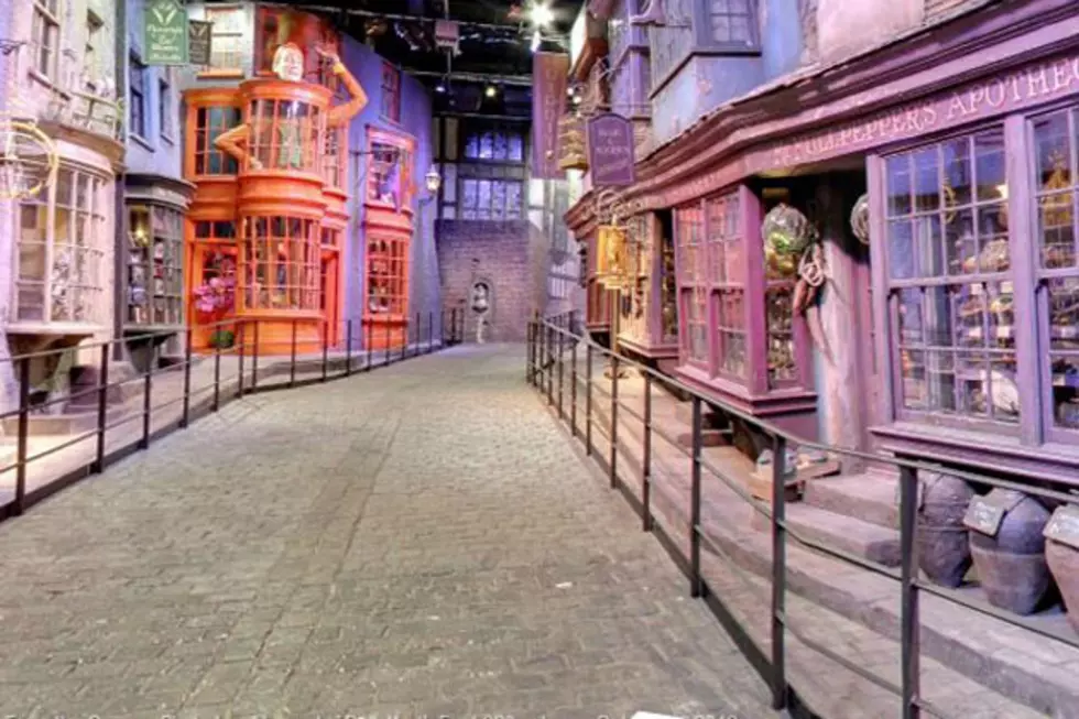
Diagon Alley Joins the Muggle World of Google Maps
Like many Harry Potter fans, we are convinced that our Hogwarts acceptance letter was hidden away by cruel parents on our 11th birthday, or else it somehow got lost in owl-post. Either way, we've been cruelly denied the opportunity to stroll the famous, cobbled street in order to shop for magical school supplies.
If you're struggling to find the Leaky Cauldron or have forgotten the brick-wand-tapping combination to enter the concealed entrance (it's three up, two across, by the way), Google Maps has a solution. Thanks to Street View, you mere Muggles (non-magic folk) can now explore the magical world of Diagon Alley from the comfort of your own homes.
The enchanted retail street Potter readers originally meet in 'Sorcerer's Stone,' where Hagrid takes Harry to buy his school supplies, is the first fictional location to be included on Google's mapping site. From the wand store, Ollivander's, to Flourish and Blotts, where Hogwarts students buy their school books, to Fred and George's magical joke shop, Weasleys' Wizard Wheezes, Google Street View's newest location allows fans a broomstick-perspective glimpse into the iconic alley.
Google's Diagon Alley can be found at the Warner Brothers Studio in Leavesden, UK, where the film franchise was based. Since the movies ended, the sets have been made open to the public, and Diagon Alley is not the only Harry Potter location Google has added to its ever-growing network of maps. By dragging the Street View symbol onto the map, you can explore other iconic sets at the studios, including Harry's cupboard under the stairs at Privet Drive.
It may not be the Marauder's Map, but Google has beautifully captured the concealed wizarding alley, allowing international Potter lovers a peek into the real life version of J.K. Rowling's magical world.
More From TheFW


